
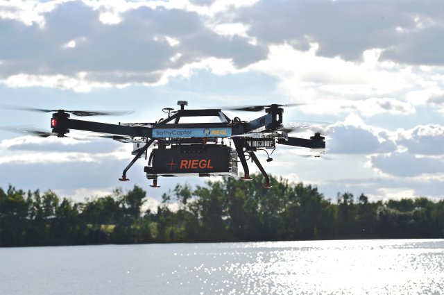
On the first day of INTERGEO, RIEGL showcased its latest development in UAS-based laser scanning: the RIEGL BathyCopter.
The BathyCopter is the world’s first Small-UAV-based surveying system capable of measuring through the water surface, ideally suited for generating profiles of rivers or water reservoirs. The robust and reliable platform design integrates the topo-bathymetric green laser depth-meter, an IMU/GNSS unit with antenna, a control unit and a digital camera.
Product leaflet available here.
About RIEGL:
The Austrian based firm RIEGL Laser Measurement Systems is a performance leader in research, development and production of terrestrial, industrial, mobile, bathymetric, airborne and UAS-based laser scanning systems. RIEGL’s innovative hard- and software provides powerful solutions for nearly all imaginable fields of application.
Worldwide sales, training, support and services are delivered from RIEGL’s Austrian headquarters and its offices in Vienna, Salzburg, and Styria, main offices in the USA, Japan, and in China, and by a worldwide network of representatives covering Europe, North and South America, Asia, Australia and Africa.
Source: Press Release