Category Archives: Geology

Emesent Launches Autonomous BVLOS Underground Drone Flight

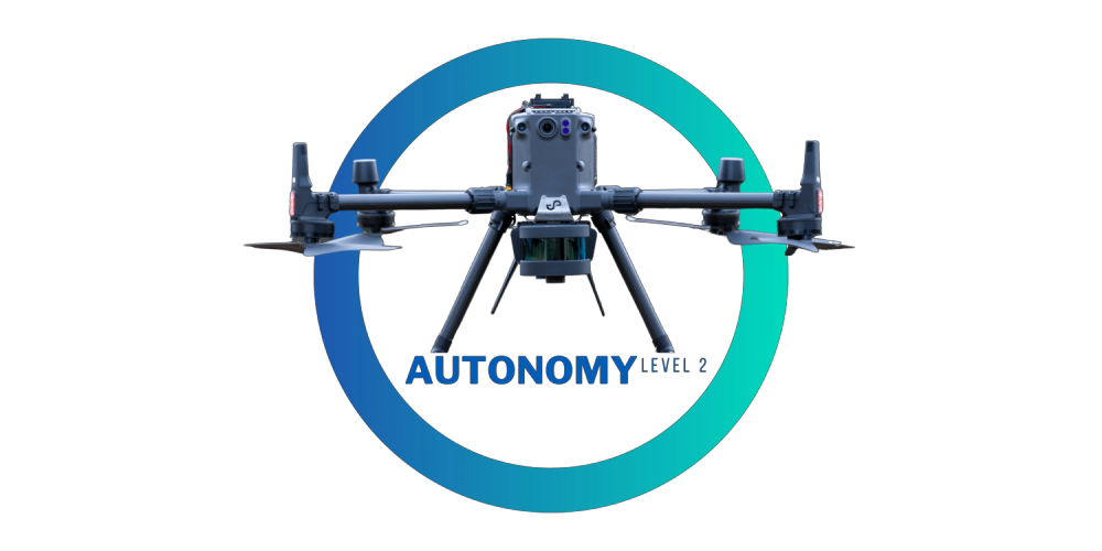
Emesent, an Australian drone autonomy company, announced a major breakthrough in the journey to fully autonomous flight systems, with the launch of Autonomy Level 2 (AL2) for Hovermap, the world’s first plug-and-play payload for industrial drones that provides autonomous beyond line of sight, GPS-denied flight. Continue reading

Mapping Submarine Groundwater Discharge with Thermal Infrared Imaging

Nadir view of Masonboro Island UAS-TIR survey region overlaid on UAS-derived DEM

Submarine groundwater discharge (SGD) is a significant part of the water cycle that delivers anthropogenically derived and naturally occurring nutrients to coastal waters. As part of the drive to develop methods to prevent the degradation of coastal water quality, research conducted at the University of North Carolina Wilmington attempts to address the ambiguity associated with SGD point source locations. Continue reading

Landscape Architects Use Drones to Collect Geospatial Data in the Galápagos

Unmanned Aerial Vehicle (UAV) collected elevation data

Accurate geospatial data is needed to plan and design coastal resilience efforts. Landscape architects use elevation representations to understand flooding, storm surges, and sea level rise. But what happens when there is no unified elevation data? Continue reading

Environmental Drone Automatically Tests Water Quality

Indra, in a temporary joint venture with the Spanish companies Sixtema and Adantia, has successfully tested the first environmental drone that automates the collection of samples in rivers and coastal areas and offers real-time information on water quality parameters. The system will be ready for launch onto the market this year. Continue reading

LiDARUSA Announces Partnership for Galaxy 950 Gas-Electric UAS

Based in Somerville, Alabama, LiDARUSA has announced a partnership with Innoflight Technology, a manufacturer specializing in UAV systems for surveying, mapping, and inspection.  As a result of the partnership, LiDARUSA is offering the Galaxy 950 platform to carry any of its sensors while consistently providing flight times over 30 minutes. Continue reading