
Forest fires are common phenomena and they often lead to fatal consequences. Both on the environment but also on people and animals living in the area.
Take the fire in Little Valley, Nevada, as an example. In October 2016, embers from a controlled burn set 10 days earlier in timber sparked and flared in the wind. When the fire was finally contained at 2291 acres, 23 homes and 17 outbuildings had been destroyed.
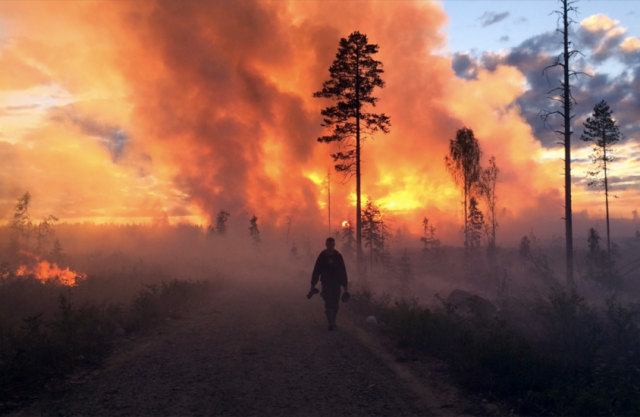
To avoid this type of hazardous situations, more and more organisations are looking into drone technology as a method to fight forest fires
In the event of a wildfire or a controlled burn, information is critical for fire management and suppression.
The scientists at the Ljungberg lab at the Swedish University of Agricultural Sciences in Umeå did a two-day field excursion to test thermal cameras in drones, joining the students at the fire management course at the forest faculty, who were going to do a prescribed burn of a 40-acre clear-cut. The scientists wanted to test their fixed wing UAV from SmartPlanes and their multi-rotor drone to capture thermal images and video.
SmartPlanes Freya equipped with a thermal camera is a powerful tool to collect information both during and after a fire. With the thermal camera, you can see the location of the fire through the smoke, but also the location and intensity of hotspots, helping the decision makers direct the firefighting activities.
After the fire, it is a very efficient way to find hotspots that might cause the wildfire to rekindle. A Freya will cover up to 450 acres in one flight with the duration of 1 hour 40 minutes. And we are here not only speaking of a perimeter search, we are speaking of the entire burn area.

Source: Press Release