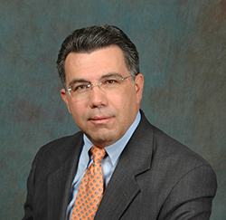
 To find out what inspires their interest in UAS and attracts the Advisory Board Members to support Drone World Expo, we scheduled a series of exclusive interviews. Our fifth interviewee is John Palatiello, Executive Director, MAPPS, an Association of Photogrammetry, Mapping and Geospatial Firms.
John is also President and Owner of John M. Palatiello & Associates, Inc. a public affairs consulting firm located in Reston, Virginia, providing government affairs and association management services to firms and organizations in the geospatial, engineering and mapping related fields. He has long been involved in public policy issues affecting the geospatial community.
He has been a contributing columnist for P.O.B. magazine, has written more than 50 papers and articles on issues affecting the geospatial community for a variety of trade and professional publications, and has testified before Congress on more than a dozen occasions on behalf of the profession.
Question: John, you’ve been Executive Director at MAPPS for 28 years now – can you tell us briefly what MAPPS is about and what its objectives are?
Answer: MAPPS is the trade association of private sector geospatial firms. It is the only association in the geospatial field exclusively comprised of private sector firms in this market. MAPPS member firms are engaged in surveying, photogrammetry, satellite and airborne remote sensing, aerial photography, hydrography, aerial and satellite image processing, GPS and GIS data collection and conversion services. Our associate members include firms that provide products and services to our member firms, as well as other firms world-wide. MAPPS is the leading advocate for market growth in the geospatial field. Our goals and activities are focused on growing the market, creating a climate for profitability, networking, collaboration, providing an opportunity to grow one’s business, education and information sharing.
Question: You are a member of a FAA rule-making advisory committee on BVLOS. Can you tell us more about this process and who else is involved on the committee?
Answer: The purpose of the BVLOS committee is to seek input from users or potential users of UAS on what the immediate, near and long-term issues/hurdles are or might be for fielding this technology. It includes a cross-section of key service providers, stakeholders and end users in such fields as aerial inspection, agriculture, cargo, communications, energy, mapping, photography, public safety, transportation, weather and wildlife.
Question: In view of your and the association’s commitment to UAS, does this mean that you see UAS as supplanting other means of gathering geospatial information?
Answer: A UAS will be another tool in the toolbox for our members. Our assessment is that UAS will be employed for data acquisition for certain projects and applications, while still utilizing manned aircraft, satellite, mobile and terrestrial or ground based systems for others.
Question: How do you rate the FAA’s approach to integrating UAS operations into the NAS? Are they being too cautious?
Answer: Is the integration taking too long? Of course it is, but I appreciate FAA’s primary focus on safety, so their caution is understandable. FAA officials have publicly stated that UAS technology is outpacing their ability to write regulations, so that is a factor as well. But I give FAA credit for creating the BVLOS committee. Remember, our committee was established and began meeting even before the Notice of Proposed Rulemaking was issued earlier this year. I give FAA a lot of credit for having the foresight to begin the next round of regulations even before they completed the first round.
Question: There’s been an explosion of interest in exhibitions and conferences about UAS in the USA this year. Why did you choose to support Drone World Expo?
Answer: MAPPS chose to participate in Drone World Expo because we believe it will attract the largest, most diverse and highest quality participants. We are co-locating our Fall Policy Conference at Drone World Expo, where we will be the exclusive geospatial content provider. Our sessions are open to MAPPS members and non-members alike. Our research has shown there are a lot of venture capital, start-up and entrepreneur interest in UAS for geospatial in Silicon Valley, so we are hopeful the San Jose location of Drone World Expo will provide us access and exposure to those individuals and an opportunity to engage in a dialogue with them.
[UAS Vision is an Official Media Partner for Drone World Expo – Ed.]
