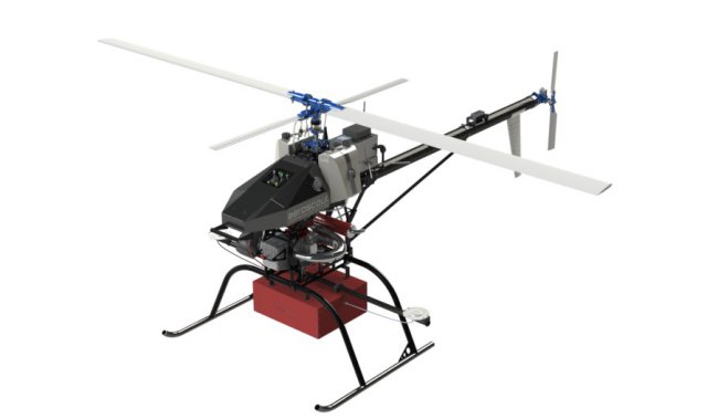
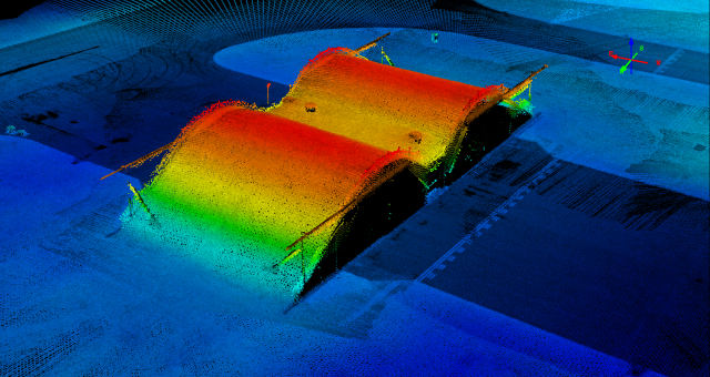
 Aeroscout in Switzerland has recently equipped several UAS helicopter systems with a combined laser/INS/GPS payload solution for airborne laser scanning.
The Aeroscout Scout B1-100 UAS is an INS/GPS controlled unmanned helicopter with a free payload capacity of up to 18kg. This payload capacity makes it possible to integrate digital cameras, video camcorders, laser scanners or multi-spectral sensors. This fully integrated helicopter provides a reliable, quick and cost-effective way of acquiring data at high resolution and accuracy.
The integration of the inertial + GPS systems means the helicopter gets invaluable measurements of position, velocity as well as roll and pitch which are essential for correcting the on-board sensors.Two GPS antennas ensure accurate and stable heading measurements during the flight. Optimal vibration isolation of the sensors on-board and a smoothly running engine further minimise the possibility of erroneous data.
The Scout B1-100 UAS has a flight endurance of up to 1.5 hours, a flying altitude above mean sea level (AMSL) of up to 1000m and is characterised by high manoeuvrability. Other features such as fully autonomous take-off, “auto homing”, and automatic landing with engine shut-down differentiate this unique UAS helicopter.The Scout B1-100 UAS helicopter in combination with the laser/INS/GPS payload can be used for a wide range of airborne applications such as aerial mapping of coastal lines, cultural heritage sites or forests, or power line mapping.
The flight missions can be planned from the Aeroscout Ground Control Station which provides all capabilities in order to operate the Aeroscout unmanned autonomous helicopter. This includes mission planning, mission control, display of UAS status information, and UAS performance monitoring.
The Aeroscout Ground Control Station allows both assisted flight mode (velocity control by joystick input) and fully autonomous mode (GPS waypoints). The ruggedized computer keyboard allows all mission planning and modifications on the field. In addition, several USB ports are available for mission download or data upload. The main screen shows all UAS status information, while the second touch screen allows the selection of major UAS commands such as take-off, landing, or engine shutdown.
Source: Press Release


We are interested in this kind of UAV, but need some technical information in order to validate business posibilities
Size of equipment
How many nautic miles can cover
Do you have some expertise using this euipment on board of one OPV
Best regards
Guillermo,
To contact Aeroscout, click on the link in the article which takes you to their web site where you will certainly find a”Contact Us” page…